Demo
The Berlin metro system is used as a testing ground for the components developed for OpenMetroMaps. The examples below feature the work-in-progress maps of Berlin.
Web Viewer
Here are links to instances of the JavaScript view:
- Berlin, schematic
- Berlin, geographic
- Berlin, nick names
- Vienna, schematic
- Vienna, geographic
- Stuttgart S-Bahn, schematic
- Stuttgart S-Bahn, geographic
Map Editor
This is a screenshot of the Map Editor, which is used for creating and editing maps: 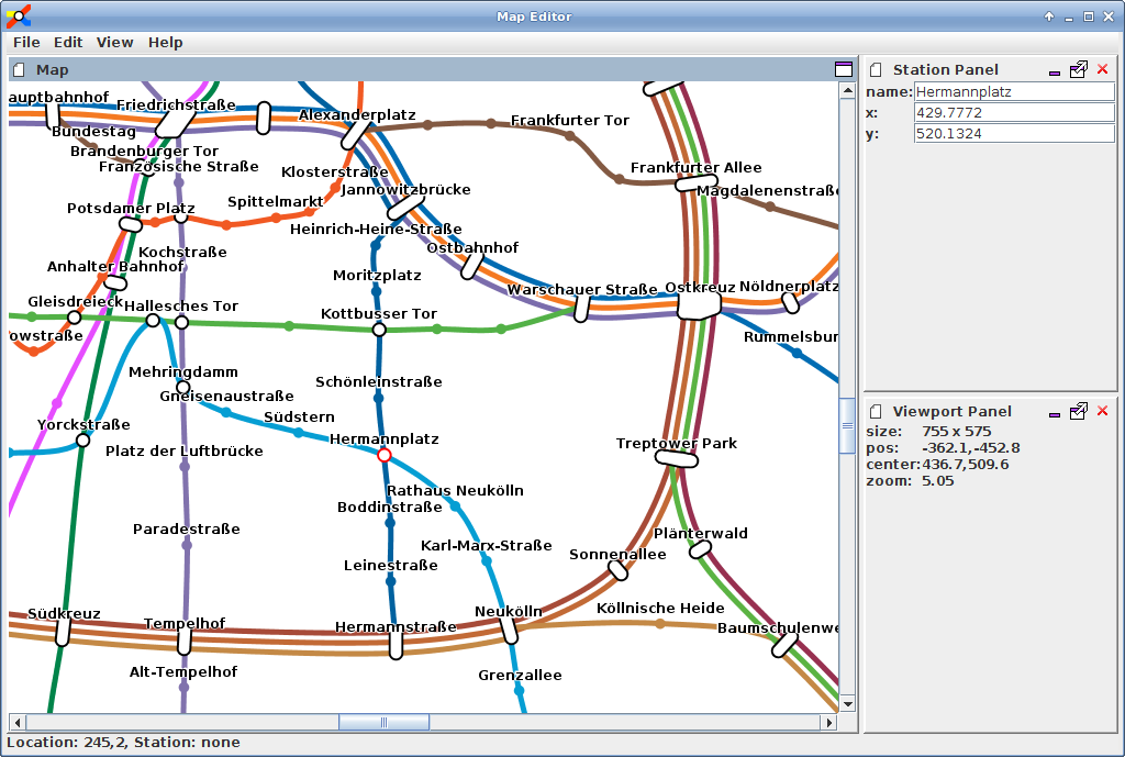
File Format
One major goal of OpenMetroMaps is to define a file format for storing metro maps. The current draft is a relatively simple XML-based document. It has not been formally specified yet, but there are existing files and running code that reads and writes data in such a format. Have a look at this example document from the main repository: berlin.omm